Our precision is our promise
Geodetic monitoring of construction sites
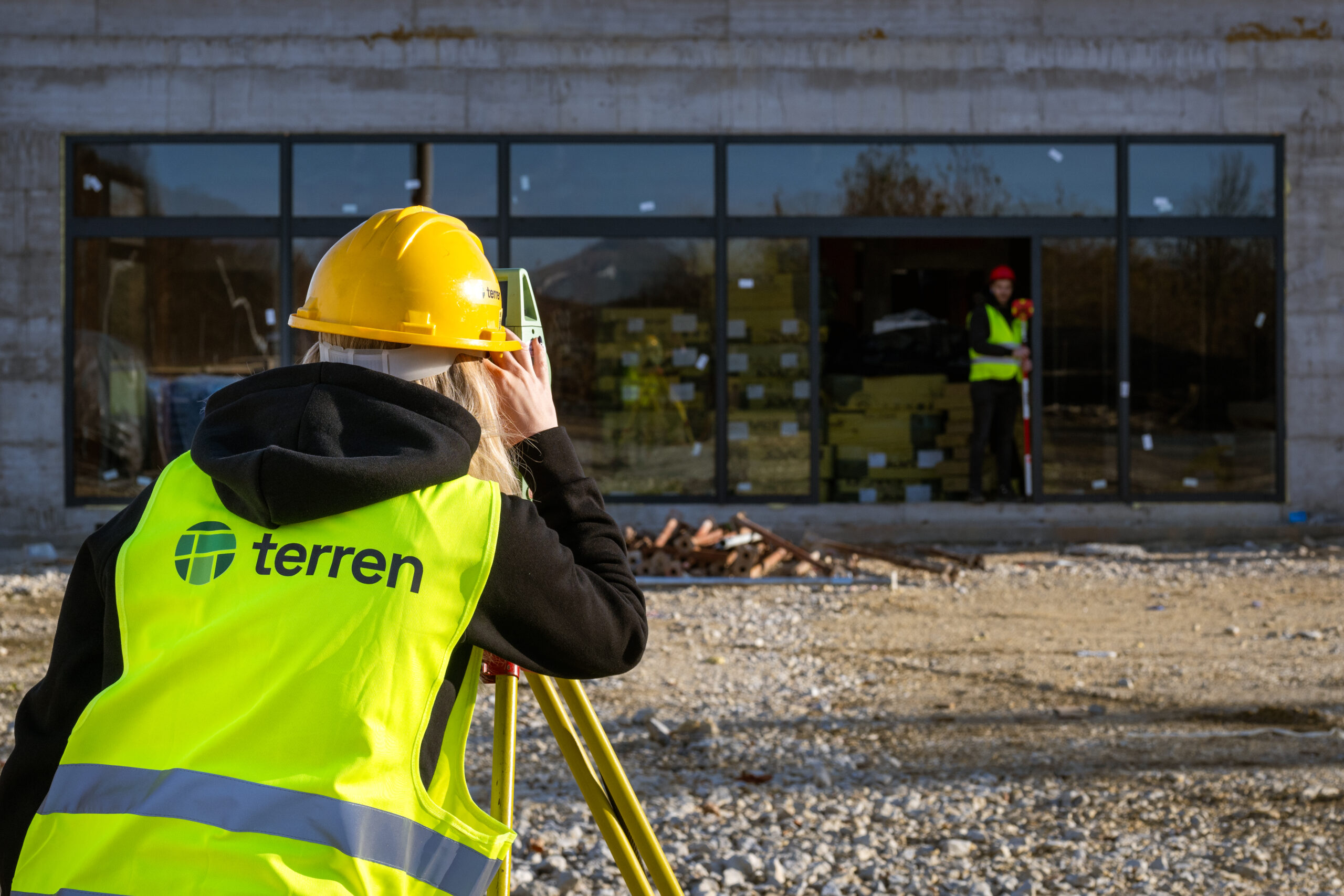
Geodetic monitoring of construction sites is extremely important when supervising facilities that are under construction, regardless of whether they are building or civil engineering. It includes staking out the necessary construction work, controlling the completed construction work, and preparing as-built reports.
Geodetic monitoring of construction sites involves continuous or periodic geodetic recording, measurement and analysis of the situation on the construction site during the execution of works. The goal is to ensure that all construction works are carried out according to the project, legal regulations and technical standards, and that any deviations and problems are detected in a timely manner.
Thanks to the professional and dedicated approach of our team, as well as modern geodetic practices and instruments, we ensure high accuracy when performing work.
Engineering geodesy is a special branch of geodesy that deals with geodetic monitoring and supervision of objects during construction. Geodetic practices within this branch serve to precisely determine the position, height, shape and dimensions of objects, as well as to ensure their accurate geometry and stability during construction.
Testimonials
Customer satisfaction is our top priority.

"Working with Terren was an excellent experience. Their expertise, precision, and speed in resolving all surveying tasks far exceeded my expectations. As an investor, it was important to me to have a reliable partner who understood all the steps in the process."
Marija Penić-Ivanko, director of the company "Mare", private investor from Krašić

"The entire team deserves every compliment for the work done related to the cadastral plots and the floor plans that I needed after my parents died. Everything was in complete disarray, but they managed to resolve all the problems and help with the legal aspects."
Željka Čorhodžić
“My many years of experience working with Terren have been very positive. Very professional approach. They guided me throughout the entire process and communicated regularly until the work was completed. I recommend Terren to anyone who wants precise and reliable results.”
Višnjica Malović
“Two years ago we bought a family house in Slunj with land. We needed surveying services, and on the recommendation of the old owners we came to Terreno. We are more than satisfied with their work. Fast, high-quality and very friendly service.”
Predrag Ugarković
Based on focused and dedicated work within set deadlines.
FAQ
What are the main activities during geodetic monitoring of construction sites?
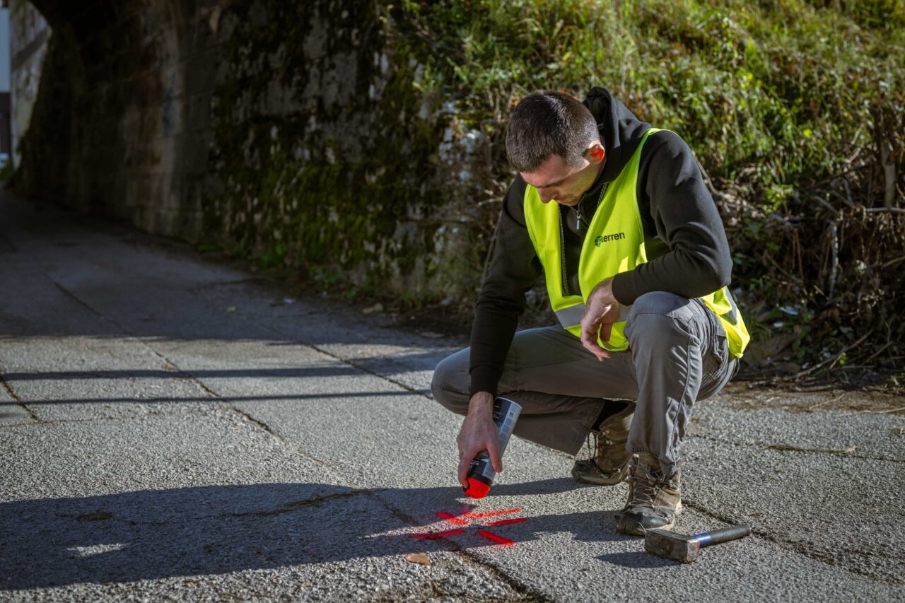
Benchmarks, orientation points, and control points necessary for precise measurement throughout construction are set up.
Stakeout control
It is checked that all construction axes, baselines, and object positions are marked out on the construction site exactly according to the project.
Monitoring of deformations and displacements
Regular measurements monitor the movement of structures (e.g. embankments, walls, foundations) in order to detect any potential damage or safety risks in a timely manner.
Control and performance recordings
Recording the condition after completion of individual phases of work (e.g. finished foundations, completed floors) for comparison with the design and documentation of the completed condition.
Preparation of reports and documentation
Regular reports for investors, supervising engineers and contractors with deviations and recommendations for corrective work if necessary.
Why is geodetic monitoring of construction sites important?
Also, properly conducted geodetic monitoring is often a necessary condition for a successful technical inspection and obtaining a use permit.
Geodetic monitoring of construction sites brings us:
1. Construction quality and safety – Detects errors before they become a serious problem.
2. Project compliance – Reduces the risk of additional costs due to corrections.
3. It is a legal obligation – In many projects it is prescribed by laws and standards.
4. Monitoring the dynamics of work execution – Helps in the organization and optimization of the construction site.
5. Documentation for technical inspection – Required for use permit.
Instruments and technologies used?
Total stations – for precise measurements of distances and angles.
GNSS systems (GPS) – for positioning and monitoring of wider areas.
Digital levels – for precise height measurements.
3D laser scanning – for fast and detailed recording of objects and terrain.
Drones (UAV) – for aerial photography of large construction sites.
Data processing software – CAD, BIM systems, geodetic software for displacement and deformation analysis.
What are the typical problems that can be detected by geodetic monitoring?
– Misalignment of the foundation with the designed position
– Settlements and movements in embankments and retaining walls
– Unplanned deviations in floor heights
– Deformation of structural elements due to poor workmanship