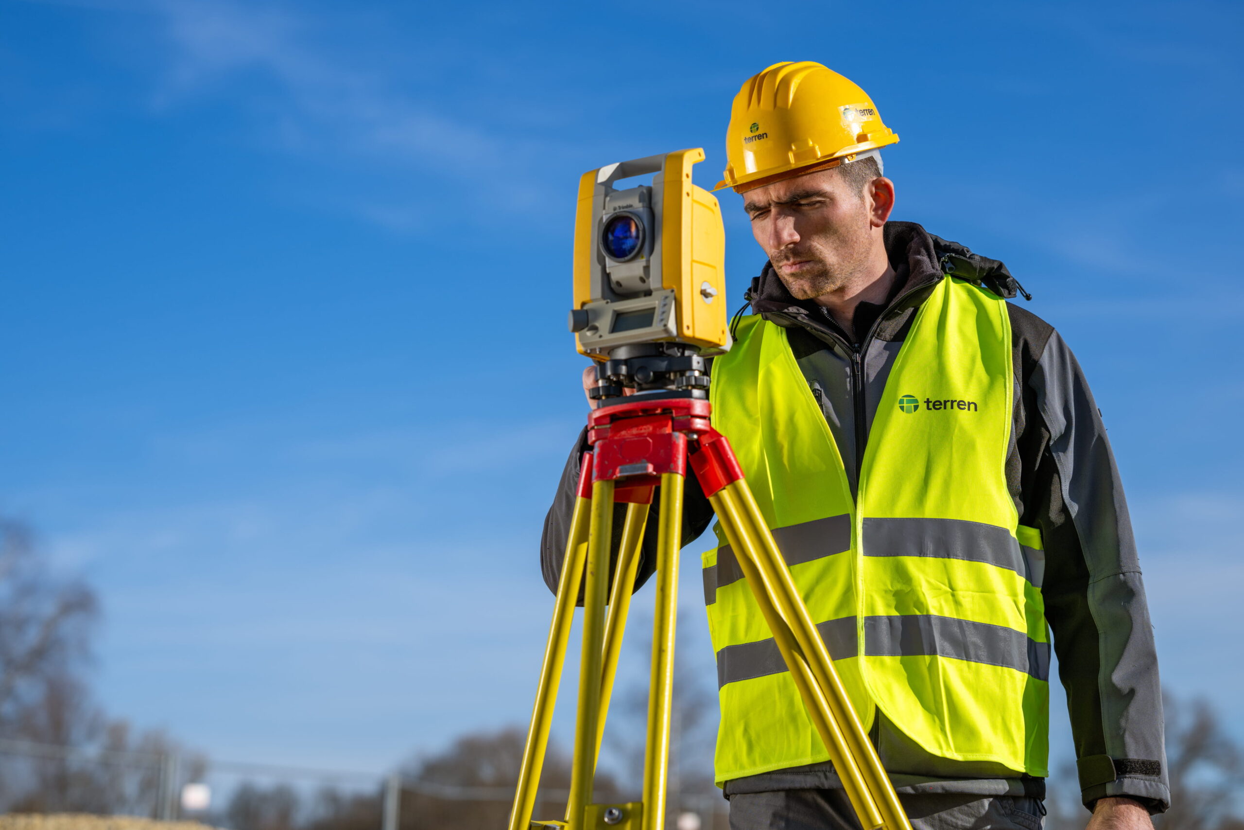
We measure thoroughly and accurately
Legalization 2026 – new Law
If you have a concrete object for legalization, now is the right moment to prepare the documentation according to the current law (geodetic study, snapshot of the constructed state, evidence of the object’s age, etc.).
Amendments to the Act on the Treatment of Illegally Constructed Buildings were adopted at the Government session on 14 January 2026. The amendments to the law will allow buildings constructed before 21 June 2011 to be legalized.
Permanent submission of requests.
Although the public often talks about the “new wave of legalization”, it is important to emphasize that the fundamental reason for changing the current law was the abolition of the deadline for legalization application, which was set for June 30, 2018, that is, until then, citizens could apply for legalization. The amendment of the law made it possible to submit a request for legalization even after that deadline, that is, it is possible to permanently submit a request.
It will not be possible to carry out legalization in locations such as maritime areas, nature parks, infrastructure corridors, forest and water lands, etc.
With the new amendments to the Act, the process has been completely digitalized, as announced by the Government, and the request is submitted through the ISPU system with the necessary documentation attached.
Key news from the new Law
The following changes are important to highlight:
1. Cancellation of the deadline for submitting applications
Abolition of the time limit for submitting a request for legalization. The request can be submitted at any time.
2. Retention of the cut-off date – June 21, 2011.
Despite the lifting of the deadline, the scope of legalization is not expanding. Only buildings that are visible on DOF5/2011, that is, those that were built or added to by 21.6.2011, will still be able to be legalized.
Anything built after that date will not be able to be legalized.
3. Stricter prohibition of legalization in infrastructure corridors
Provisions related to infrastructure corridors are additionally being tightened. Legalization will be completely prohibited in the corridors: transport, energy, water and communication infrastructure.
The previous possibilities for exceptions with the consent of public law bodies are being abolished.
4. Digitalization of the procedure
The complete digitalization of the process of issuing a decision on the completed status through the ePermit system is planned.
It is introduced:
- nova Uredba o naknadi za zadržavanje nezakonite zgrade u prostoru, s ažuriranim i vjerojatno višim iznosima naknada.
- unified documentation (abolition of division into building categories),
In parallel with the amendments to the Law on Legalization, as part of the package of laws related to affordable housing, the Government announced an additional tightening of the policy towards illegal construction:
- Illegal construction should become a criminal offense,
- legalization will be strictly limited only to buildings built by June 21, 2011. for which no application was previously submitted,
- a new wave of legalization for new construction is not planned after that date.
The goal, as stated, is solely to “clean up the tails” of old illegal construction, not to open up space for new illegal activities.
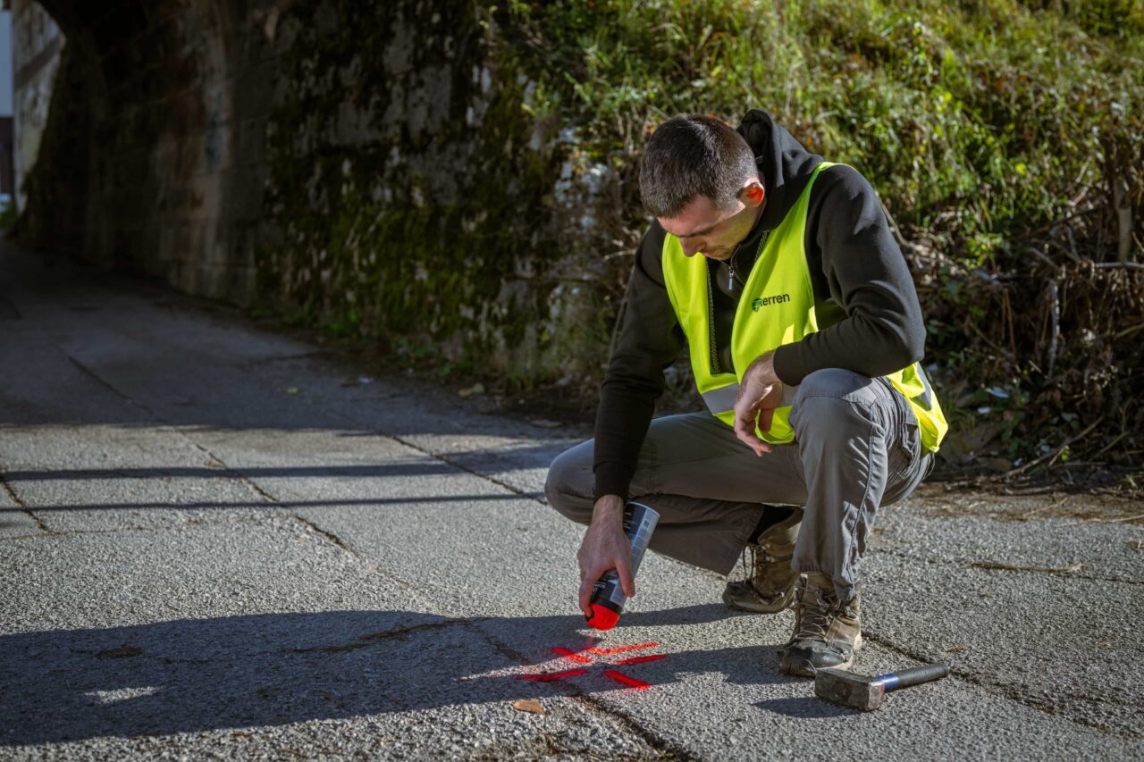
Technical and professional documentation
01
Geodetic survey of the as-built condition of an illegally constructed building,
made as part of the geodetic study,
02
As-built snapshot
prepared by a licensed architect or licensed civil engineer,
03
Statement from a certified engineer
which confirms that the building meets the requirements for mechanical resistance and stability according to the regulations in force at the time of its construction,
04
Certificate from the competent cadastral authority
that the building is recorded and visible on the official orthophoto from 2011 (DOF5).
05
Fee for maintaining an illegally constructed building in the area
In addition to the documentation, the applicant is also obliged to pay a fee depending on the location, size of the facility, and its purpose, which generally increases with the scope and value of the project.
Testimonials
Zadovoljstvo klijenata nam je na prvom mjestu

“Terren stands out for its unparalleled expertise and excellence. From the first meeting to the final delivery, the team demonstrated a high level of professionalism. Detailed reports and clear communication throughout the process facilitated understanding and decision-making. The project was completed on time and within the agreed budget.”
Lawyer and mediator Ruđer Anić, partner at the law firm Anić and partners

“As an architectural firm, we have been working with Lemax/Terren for many years regarding geodetic services and have only had positive experiences. Very accommodating and cooperative, fast and efficient.”
Certified Architectural Engineer Ivan Kapov, Director of the architectural bureau Kapov doo

"We decided to cooperate with the Terren surveying office because of their exceptional professionalism and ease of communication, and their quick and concrete response has been proven through years of cooperation on numerous projects."
Krešimir Vučko, director of Duotempus d.o.o., private investor
“The entire team deserves every compliment for the work done related to the cadastral plots and the floor plans that I needed after my parents died. Everything was in complete disarray, but they managed to resolve all the problems and help with the legal aspects.”
Željka Čorhodžić
“My many years of experience working with Terren have been very positive. Very professional approach. They guided me throughout the entire process and communicated regularly until the work was completed. I recommend Terren to anyone who wants precise and reliable results.”
Višnjica Malović
“Two years ago we bought a family house in Slunj with land. We needed surveying services, and on the recommendation of the old owners we came to Terreno. We are more than satisfied with their work. Fast, high-quality and very friendly service.”
Predrag Ugarković

"We regularly cooperate with the Terren surveying team and we are very satisfied! Everything is always done professionally, precisely and in a very short time. High level of professionalism and a warm recommendation to anyone who needs reliable services."
Jelena Kravoščanec Todorović, direktorica Opereta nekretnine

"Working with Terren was an excellent experience. Their expertise, precision, and speed in solving all geodetic tasks far exceeded my expectations. As an investor, it was important to me to have a reliable partner who understands all the steps in the process."
Marija Penić-Ivanko, direktorica tvrtke "Mare", privatna investitorica iz Krašića
Based on focused and dedicated work within set deadlines.

FAQ
The facility was built to date, but is not in accordance with the spatial plan?
Property in an area where construction is not allowed?
Can I still legalize the facility in 2026?
What if my building was added to after 2011?
How long does the legalization process take?
What if I don't legalize the facility?
Can I submit the application myself?
The documentation must be signed by a certified surveyor and architect.