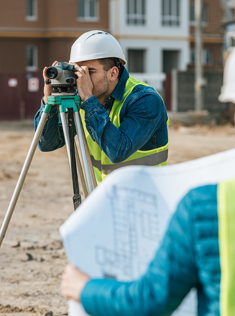
Geodetic services for local government and self-government units
We work to contribute to creating a better future for your institution, municipality or city. Thanks to our certificates, regular training and experience, we carry out the most diverse and complex projects. We participate in carrying out cadastral surveys at the level of one or more municipalities as part of the Multi-Year Cadastral Survey Program.
Testimonials
Customer satisfaction is our top priority.

“Terren stands out for its unparalleled expertise and excellence. From the first meeting to the final delivery, the team demonstrated a high level of professionalism. Detailed reports and clear communication throughout the process facilitated understanding and decision-making. The project was completed on time and within the agreed budget.”
Lawyer and mediator Ruđer Anić, partner at the law firm Anić and partners

“As an architectural firm, we have been working with Lemax/Terren for many years regarding geodetic services and have only had positive experiences. Very accommodating and cooperative, fast and efficient.”
Certified Architectural Engineer Ivan Kapov, Director of the architectural bureau Kapov doo

"We decided to cooperate with the Terren surveying office because of their exceptional professionalism and ease of communication, and their quick and concrete response has been proven through years of cooperation on numerous projects."
Krešimir Vučko, director of Duotempus d.o.o., private investor
“The entire team deserves every compliment for the work done related to the cadastral plots and the floor plans that I needed after my parents died. Everything was in complete disarray, but they managed to resolve all the problems and help with the legal aspects.”
Željka Čorhodžić
“My many years of experience working with Terren have been very positive. Very professional approach. They guided me throughout the entire process and communicated regularly until the work was completed. I recommend Terren to anyone who wants precise and reliable results.”
Višnjica Malović
“Two years ago we bought a family house in Slunj with land. We needed surveying services, and on the recommendation of the old owners we came to Terreno. We are more than satisfied with their work. Fast, high-quality and very friendly service.”
Predrag Ugarković

"We regularly cooperate with the Terren surveying team and we are very satisfied! Everything is always done professionally, precisely and in a very short time. High level of professionalism and a warm recommendation to anyone who needs reliable services."
Jelena Kravoščanec Todorović, direktorica Opereta nekretnine

"Working with Terren was an excellent experience. Their expertise, precision, and speed in solving all geodetic tasks far exceeded my expectations. As an investor, it was important to me to have a reliable partner who understands all the steps in the process."
Marija Penić-Ivanko, direktorica tvrtke "Mare", privatna investitorica iz Krašića
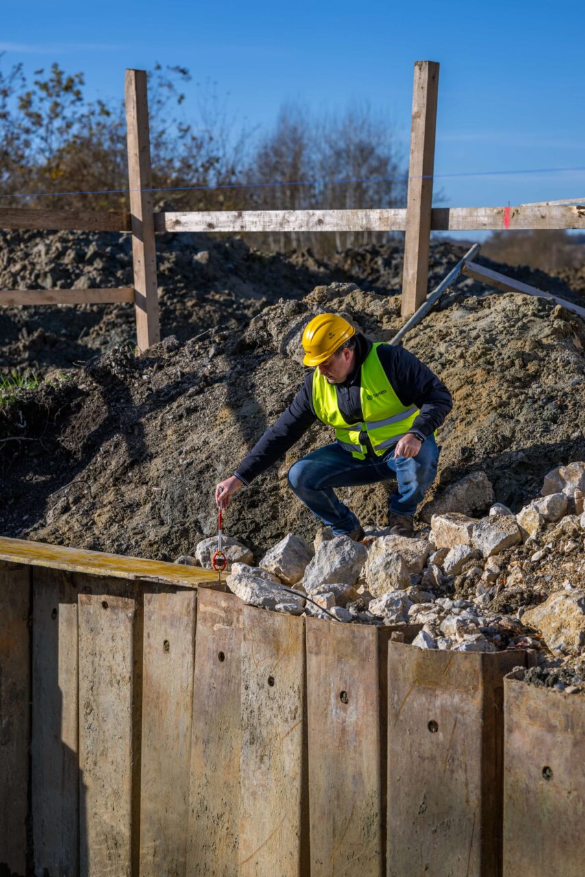
Reconstruction of buildings damaged by the earthquake
The project included the renovation of buildings in the area of the City of Zagreb, Krapina-Zagorje County, Zagreb County, Sisak-Moslavina County and Karlovac County. It included geodetic services for the preparation of geodetic situations of the actual state for design purposes (geodetic bases), geodetic studies for recording the actual position and for division or merger (parcelation), staking out building plots, staking out buildings, preparation of a statement by a certified geodetic engineer, geodetic studies for recording buildings.
In the public tender for geodetic services in May 2023, we were selected as the contractor by the investor, the Agency for Legal Transactions and Real Estate Brokerage (APN). The geodetic services included complete monitoring of the works from design (creation of a geodetic situational drawing of the actual state), construction (staking out the building) and recording the building in the cadastre and land registers (building registration).
APN is the investor in this proceeding who, on its own behalf and for the account of the Republic of Croatia, is carrying out the construction of multi-apartment buildings for temporary care in the municipal districts of Hrvatska Kostajnica, Kutina, Novi Sisak and Sisak Stari.
Within this contract for geodetic services, the construction of 35 buildings is foreseen, and the act on the basis of which they will be built is the Decision on the type project.
As part of this contract, we had the opportunity to work with all the construction contractors. Regardless of the standard projects, each of the contractors had different requirements in terms of staking out the building elements on the site. Therefore, good communication and good preparation before the site were two key things that we had to pay special attention to.
Given the short deadlines, it was crucial to go out into the field as soon as possible, preferably the next day after receiving the invitation, and then deliver the stakeout report that had to be on the construction site.
On most construction sites, we staked out on a drift scaffold using a total station, while some contractors requested stakeout without a drift scaffold. We made sure to measure the staked out elements, and the data was checked in the office, a field report was prepared, and a stakeout study was delivered. All stakeouts have been carried out correctly, precisely and accurately so far, and we have had to go out to some sites more than once because the stakeout marks were destroyed during construction or the construction contractor requested additional checks per floor.
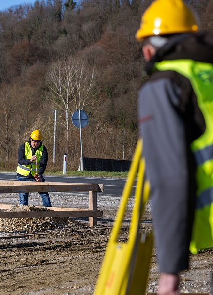
Given the short deadlines, it was crucial to go out into the field as soon as possible, preferably the next day after receiving the invitation, and then deliver the stakeout report that had to be on the construction site.
On most construction sites, we staked out on a floating scaffold using a total station, while some contractors requested staked out without a floating scaffold. We measured the staked out elements, and the data was checked in the office, a field report was prepared, and a stakeout study was delivered. All stakeouts have been performed correctly, precisely, and accurately, and we had to go out to some sites more than once because the stakeout marks were destroyed during construction or the construction contractor requested additional checks per floor.
References
Konzum business building, Brckovljani
Geodetic survey of the completed state and geodetic study

TŽV Gredelj
RECONSTRUCTION AND EXTENSION OF THE “TŽV GREDELJ” COMPLEX, ZAGREB , geodetic survey of the as-built condition of 20 km of lines in the area of TŽV Gredelj, Vukomerička cesta, Zagreb.

Altpro d.o.o., Križevci-Koprivnica-state border railway
RECONSTRUCTION OF THE EXISTING AND CONSTRUCTION OF A SECOND TRACK
ON THE RAILWAY SECTION KRIŽEVCI – KOPRIVNICA – STATE BORDER
—
Geodetic services for the construction of a cable network as part of the project
State Geodetic Administration, new cadastral survey
NEW CADASTRAL SURVEY, MUNICIPALITY OF MALJEVAC
—
New cadastral survey of the cadastral municipality of Maljevac, area over 500 hectares, 1220 cadastral plots included.
FAQ
How much does a geodetic study cost?
The price is defined depending on the purpose, location, size of the plot, compliance with the cadastre and land registry, etc.
When planning to request the services of a surveyor, the basic information you need to prepare is the cadastral plot number and the name of the cadastral municipality or the address of the building (if there is a building on the plot). Based on the information about the plot and the purpose of the study, the surveyor will be able to tell you what purpose the study you need is for and what the price of the service will be.
What documents are needed to create a geodetic study?
Why are geodetic services crucial for complex construction projects?
What surveying services are required before construction begins?
– Geodetic survey of the actual condition,
– Geodetic elaboration of subdivision (if new parcels are formed),
– Harmonization of cadastral and land registry status,
– Creation of geodetic base for design.
Who all participates in the geodetic part of a construction project?
– investors,
– architects and designers,
– lawyers (for ownership issues),
– cadastral offices and – land registry departments,
– contractors and supervising engineers.
Why are large construction projects more geodetically complex?
How do surveyors help coordinate complex projects?
– Mass subdivisions and preparation of studies for multiple plots,
– Data reconciliation between the cadastre and land registers,
– Staking out large systems of installations and roads,
– Professional geodetic supervision throughout the entire construction phase,
– Volumetric calculations (excavations, embankments),
– Detailed monitoring of deformations and displacements of objects.